
It’s not unheard of for standard navigation apps to map out a less-than-ideal pedestrian journey. You technically can walk under that bridge and cross that six-lane highway, but that doesn’t mean you want to. The app doesn’t take into account your safety, nor your comfort in steamy weather. Now, a team at Arizona State University (ASU) is developing a tool to tackle the latter aspect of the problem.
The aptly-called Cool Routes is an online navigation system that calculates sun exposure and mean radiant temperatures to suggest cooler (in the temperature sense) pedestrian routes. A radiant temperature measurement represents the total heat load one experiences in a particular spot. The measurement takes elements like sun exposure and reflected heat into account to better describe just how hot a space will be.
The mean radiant temperature in Phoenix in the sun can go over 150 degrees Fahrenheit, but decrease to under 100 degrees in the shade. Cool Routes updates its data hourly based on meteorological forecasts and also takes into account buildings and trees.
“Cool Routes is a website running on a server, and anybody can use it. A user can open it in a browser, pick where they want to start and where they want to go on the ASU Tempe campus, and see walking routes that account for heat exposure,” Ariane Middel, director of ASU’s SHaDE Lab, tells Popular Science. “It looks like a navigation map, but with a heat layer added. Instead of only asking, ‘What is the shortest way to get there?’ Cool Routes also asks, ‘What is the cooler way to get there?’”
During tests spanning 12 days and different seasons on ASU’s Tempe Campus, Cool Routes successfully found cooler routes over 70 percent of the time, including during mornings and evenings, when there’s usually less of a difference in heat loads between shaded and sunny areas. These paths decreased the perceived heat load by around 4.5 degrees on average.
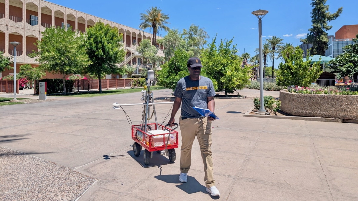
To confirm Cool Route’s heat exposure estimates, the team also used a rolling instrument station that measures human thermal exposure among other data., Their results were significantly accurate. Middel and her colleagues describe their work in a study recently published in the journal Building and the Environment.
“One of the main things we found is that people often do not need to take a very large detour to reduce their heat exposure. In many cases, a slightly longer route can be substantially more shaded compared with the shortest route,” Middel explains.
“I would definitely walk 10 extra minutes to get more shade and protect myself from UV exposure. But everyone makes that decision differently,” says Waqar Khan, an ASU computer scientist and co-author of the study. “Some people may choose the cooler route, while others may prefer the shortest one. That is why, in our application, we show both the shortest and coolest routes, along with the route length, estimated walking time, and expected heat exposure.”
Cool Routes currently only works for ASU’s Tempe Campus, but the approach can be applied to identify pedestrian paths in other areas, including cities. What’s more, the researchers believe that Cool Routes data could help city planners find the best places for shade solutions, and even test out potential future cooling strategies via heat load simulations.
Moving forward, the team, including ASU computer science student and co-author Fletcher Emmott, aims to increase the tool’s accessibility with a Cool Routes mobile application as a part of Emmott’s honors thesis.
The post Arizona students design app that calculates least-sweaty walking route appeared first on Popular Science.